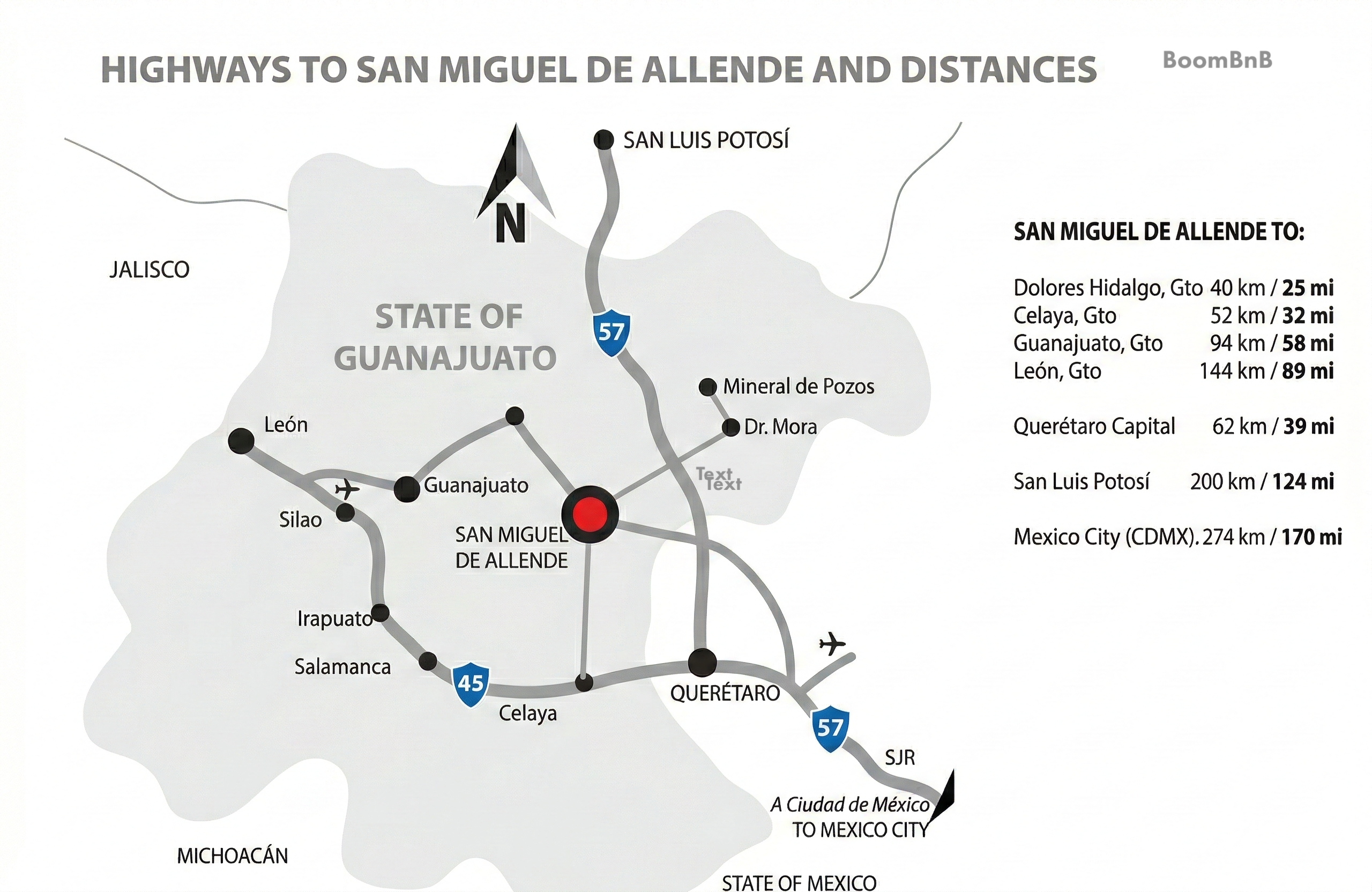
San Miguel de Allende is located in the State of Guanajuato. The state is bordered by San Luis Potosí to the north, Jalisco to the west, Querétaro to the east, Michoacán to the southwest, and the State of Mexico to the southeast.
Traveling by Car
If you are arriving by car, the main highway access routes are:
- Celaya – Comonfort – San Miguel de Allende
- Guanajuato – San Miguel de Allende
- Dolores Hidalgo – Atotonilco – San Miguel de Allende
- Mineral de Pozos – Dr. Mora – San Miguel de Allende
- Querétaro – Santa Rosa Jáuregui – San Miguel de Allende
Airports
San Miguel de Allende does not have its own airport. The nearest options are:
- 40.4 miles / 65 km away from Querétaro International Airport. (QRO)
- 68.4 miles / 110 km away from Guanajuato International Airport. (BJX)
- 152.2 miles / 245 km away from Santa Lucía International Airport – AIFA. (NLU)
- 167.8 miles / 270 km away from Mexico City International Airport. (MEX)
Airport Transfers:
The largest shuttle provider for transfers to San Miguel de Allende is BajioGo. Travelers also commonly rent vehicles or use Uber.
Traveling from Mexico City (MEX):
A popular alternative for those landing in Mexico City is to take a luxury bus.
-
Terminal 1: Buses depart to Querétaro.
-
Terminal 2: Buses depart to both Querétaro and Celaya.
From these cities, travelers typically take a second bus, an Uber, or get picked up by friends and family for the final leg to San Miguel.
Distances from San Miguel de Allende
- Dolores Hidalgo: 25 miles / 40 Km.
- Celaya: 26 miles / 42 Km.
- Querétaro: 39 miles / 62 Km.
- Guanajuato City: 58 miles / 94 Km.
- León: 89 miles / 144 Km.
- San Luis Potosí: 124 miles / 200 Km.
- Mexico City: 170 miles / 274 Km.